To celebrate the liberation of Arnhem which took place exactly 70 years ago today, we will take a look at the town in a fantastic selection of Then and Now pictures. We will look at the arrival of the Allies and the damage the city has sustained in the last 9 months of the war.
After the battle for Arnhem ended on September 25th 1944, the Germans forced the local population to leave the town. Nobody was allowed back in for the duration of the war and the Germans started to systematically loot the city and blowing up buildings and destroying property at random. Fires, sometimes caused by Allied shelling, burned for days because not even fire fighters were allowed back in town.
When the allies launched their final attack on Arnhem on April 13th and 14th 1945 it was a ghost town. Only German soldiers were encountered who put up a terrific fight, causing even more damage to a city already heavily damaged.
All now pictures were taken by Koos Winkelman who posted them on the Dutch WWII news website STIWOT.
We start our Then and Now journey in the center of Arnhem, click on the images for a full size version.
Liberation
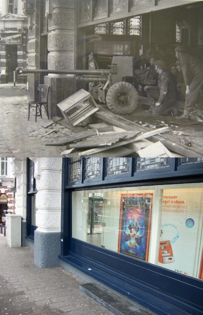
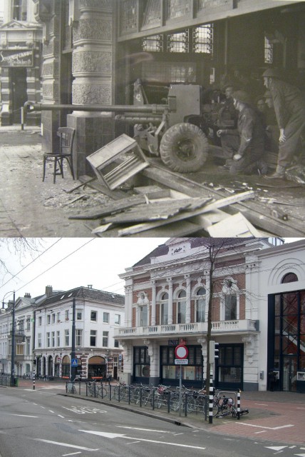 One of the most famous pictures of the liberation of Arnhem, a 6pdr anti tank gun located inside a building. It was taken on the Willemsplein, in the center of Arnhem, near the Railway station.
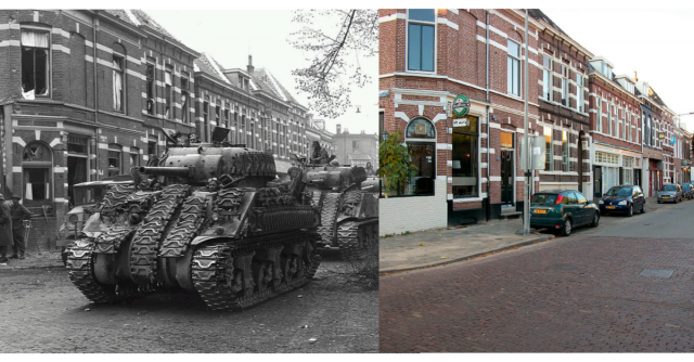
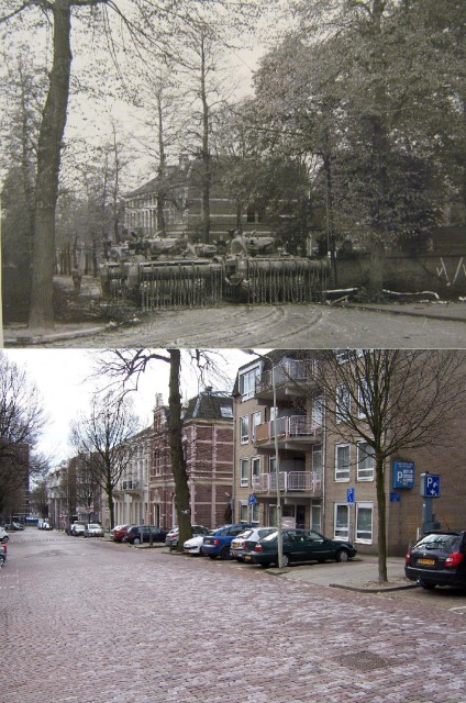 A couple of 100 meters from the Willemsplein is the Bergstraat where this picture of two mine clearing Shermans was taken.
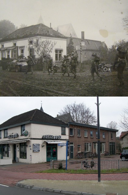
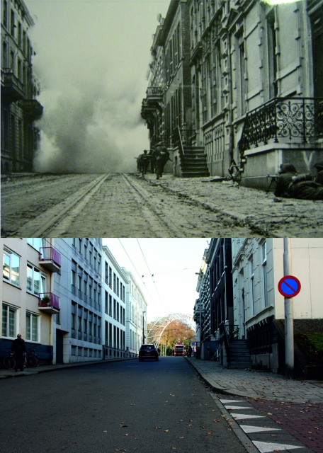 Street fighting at the Utrechtseweg, the 2nd Essex regiment moves in the direction of Oosterbeek. This is the same road where the 1st Airborne division ran into a German blocking line and could not advance further towards the bridge.
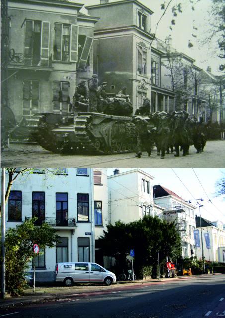 German prisoners march past a Churchill AVRE, the picture taken at the Boompjesstraat at the location of the Museum, also known as the Monistary by the 1st Airborne division. [IWM]
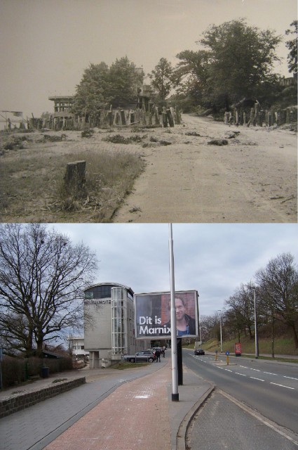 A German tank trap at the Onderlangs, on the bank of the Rhine. In September 1944 the 1st Airborne advanced towards the camera.
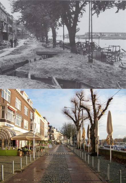 On the Rijnkade (bank of the Rhine), in the distance you can see the destroyed road bridge. The trenches were build by the Germans after the battle ended in September 1944, fearing an assault river crossing in the city.
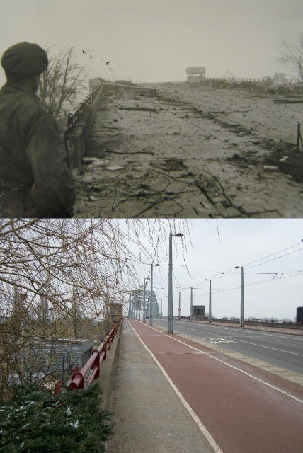 A Soldier overlooking the remains of the Road Bridge.
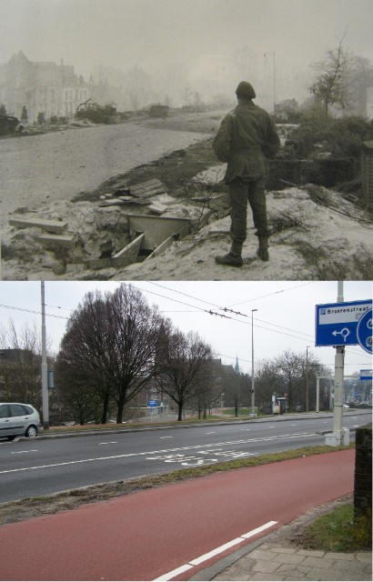 Looking the other way, German trenches in the embankment. Across the street were the Bridgade HQ and the HQ of the 2nd Battalion during in September 1944. [IWM]
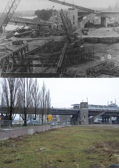 The Road bridge was bombed and destroyed by the allies in October 1944, construction of a bailey bridge began immediately after liberation.
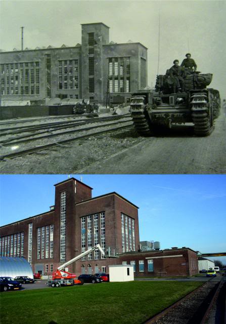 Churchill AVRE in Arnhem, 13 April 1945. [IWM]
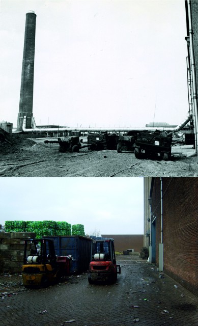 Close to the bridge is the industrial site “Kleefsewaard”.
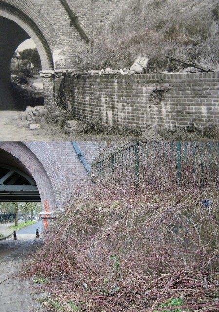 Abandoned German equipment at the Beeldhouwerstraat railway underpass.
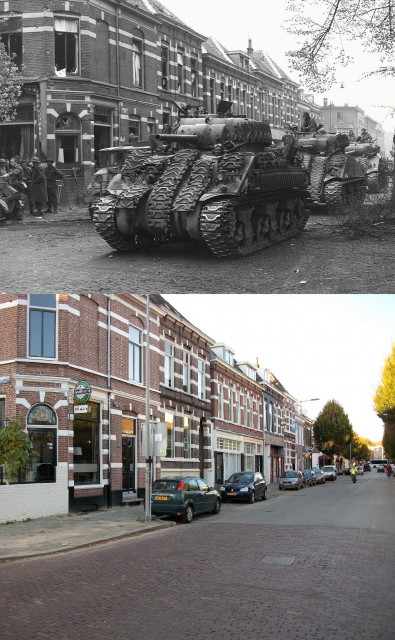 Sherman Tanks on the Hommelseweg.
Next page: Destruction of a city
Destruction of a city
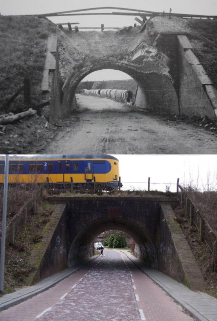 Partly destroyed railway underpass at the Vosdijk.
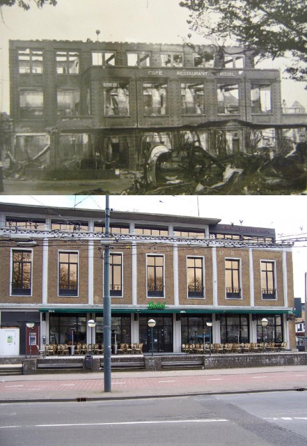 Also located on the Willemplein (where the first pictures of this article were taken), was Cafe Royal which was hit by Allied bombs on the morning of September 17th 1944. Located immediately behind Cafe Royal were German Army barracks, which were the target of the bombing, they were also destroyed.
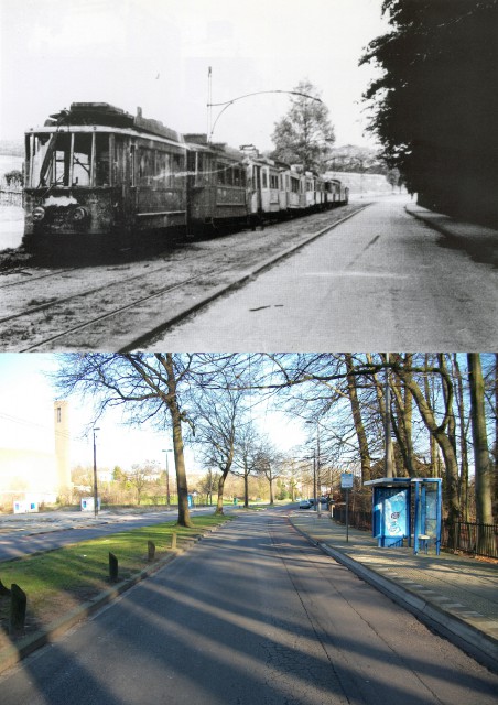 A burned out tram on the Rosendaalseweg, after the war the tram system was abandoned and a trolley bus system was built instead.
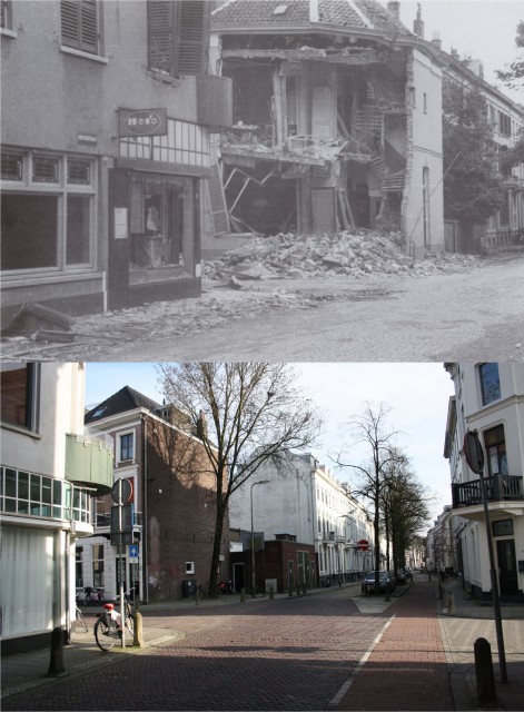
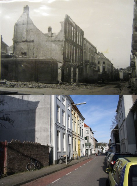
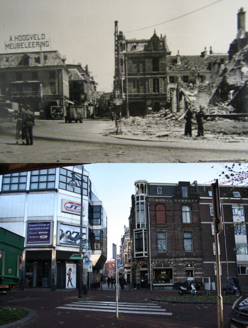 Rijnstraat in the center of Arnhem, the center of Arnhem suffered greatly under allied shelling and the subsequent fighting in 1945.
Villages surrounding Arnhem
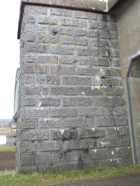
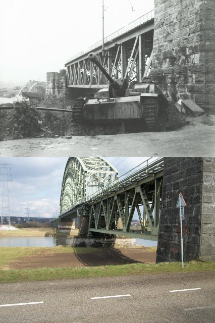 Across the Rhine near Driel at the Railway bridge underpass (called Dead mans Corner by the 101st Airborne division).
You can still see the bullet holes:
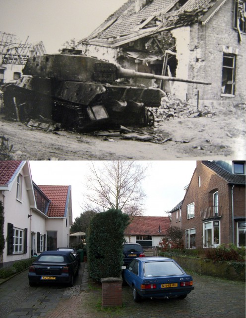 Weverstraat Oosterbeek, King Tiger destroyed by the 1st Airborne division in September 1944.
A very special thanks Koos Winkelman who took all the Now shots.
All the pictures from 1945:
Imperial War Museum collection

