With the aid of Google Earth, we have revised 10 iconic Second World War locations that were immortalised in aerial photographs.
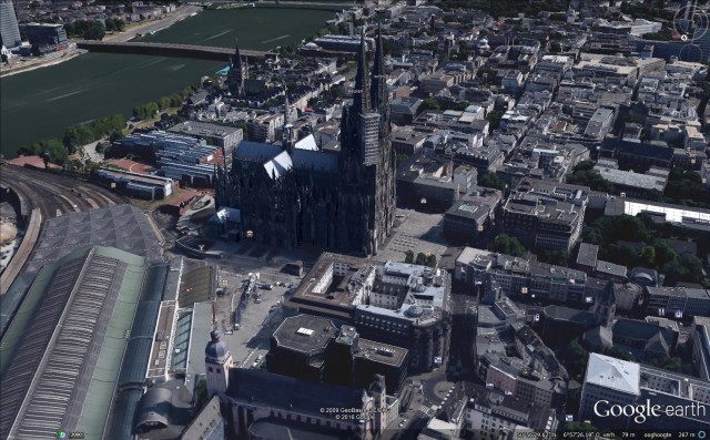
Cologne Cathedral 1944 / 2016
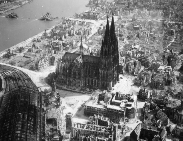
The German city of Cologne was bombed in 262 separate air raids by the Royal Air Force (RAF) during World War II. A total of 34,711 tons of bombs were dropped on the city, demolishing most of the city and her industry.
When British bombers passed overhead during the winter and early spring of 1940, causing air raid alarms to go off on more than one occasion, the first actual bombing of the city took place on 12 May 1940. The most notable attack on Cologne was the first 1,000 bomber raid which took place on May 30/31, 1942.
Despite being hit dozens of times by Brittish bombs, the city’s cathedral is clearly visible, it miraculously survived the war.
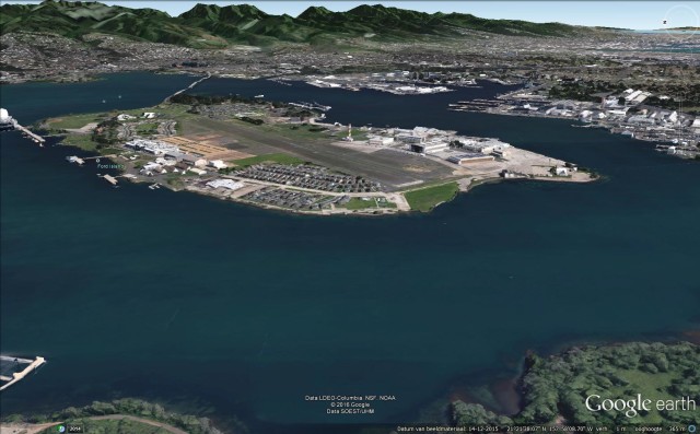
Pearl Harbor 1941 / 2016
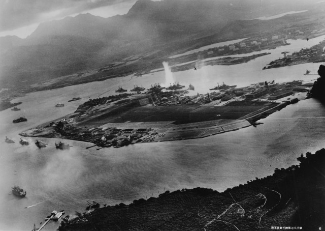
The “then” photograph was taken from a Japanese plane during the torpedo attack on ships moored on both sides of Ford Island shortly after the beginning of the Pearl Harbor attack.
The USS West Virginia, moored on the other side of Ford Island (center) has just been hit by a torpedo. The other battleships that are moored near the West Virginia are (from left): Nevada, Arizona, Tennessee (inboard of West Virginia), Oklahoma (torpedoed and listing) alongside Maryland, and California.
You can even see Japanese planes over Ford Island!
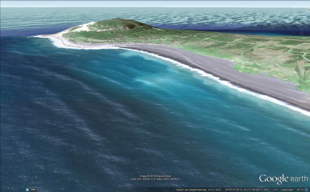
Iwo Jima 1945 / 2016
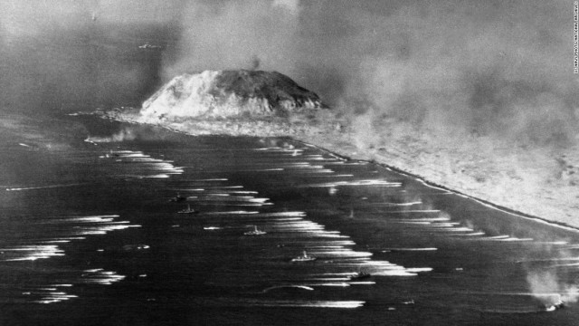
The first wave of U.S. Marines heads for the beach of Iwo Jima on February 19, 1945
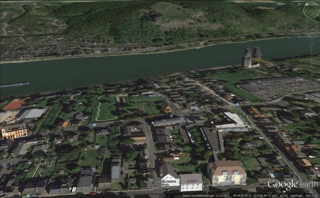
Remagen Bridge 1945 / 2016
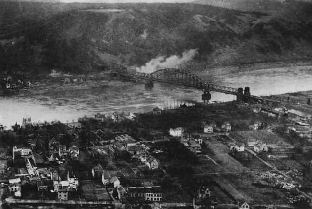
Aerial view of the Remagen Ludendorff Bridge on 15 March 1945, it was the only bridge across the Rhine river captured intact by the allies.
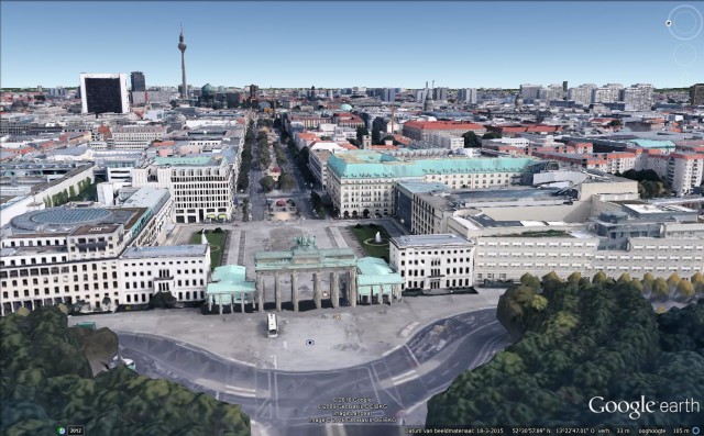
Berlin 1945 / 2016
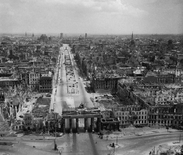
The Brandenburger gate, looking toward was what to become Soviet-controlled East-Berlin, Hitlers Reich Chancellary is on the right of the gate but not visible.
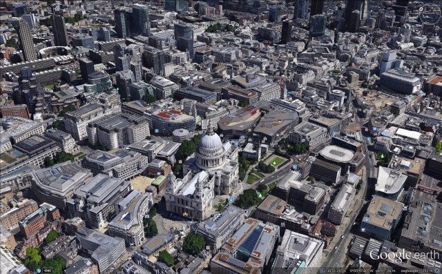
London 1945 / 2016
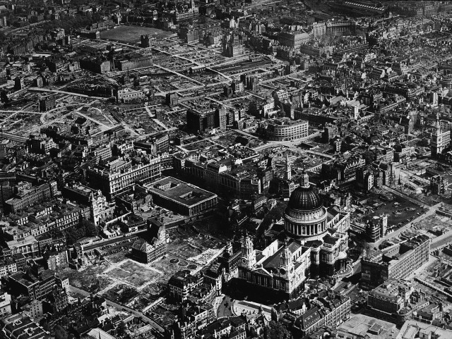
Aerial view of London – St Paul ‘s Cathedral and the City of London
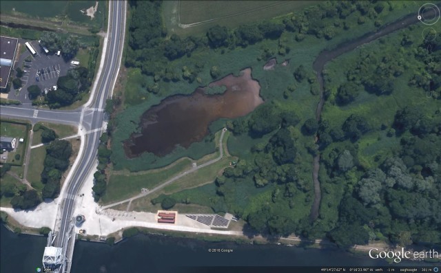
Pegasus Bridge 1944 / 2016
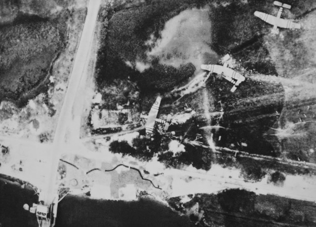
The three Horsa gliders at the Eastern end of Pegasus bridge, the circular object to the top-right of the bridge is the gun pit and trenches are also visible.
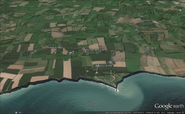
Pointe Du Hoc 1944 / 2016
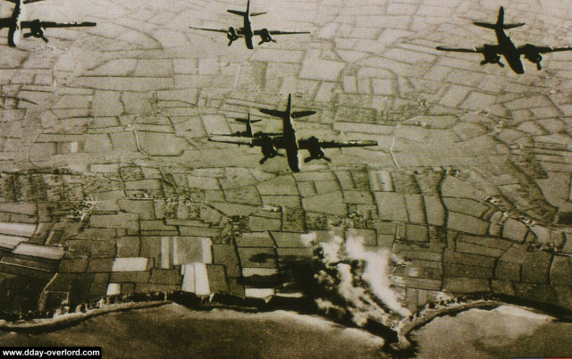
Bombarding the German gun batteries at La Pointe Du Hoc by Douglas A-20 Havoc bombers of the US 9th Airforce
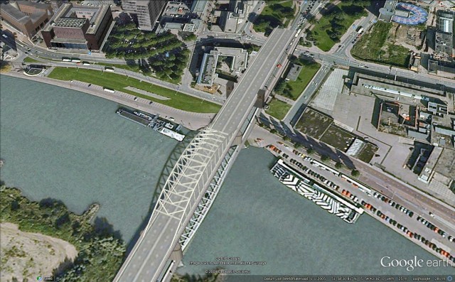
Arnhem 1944 / 2016
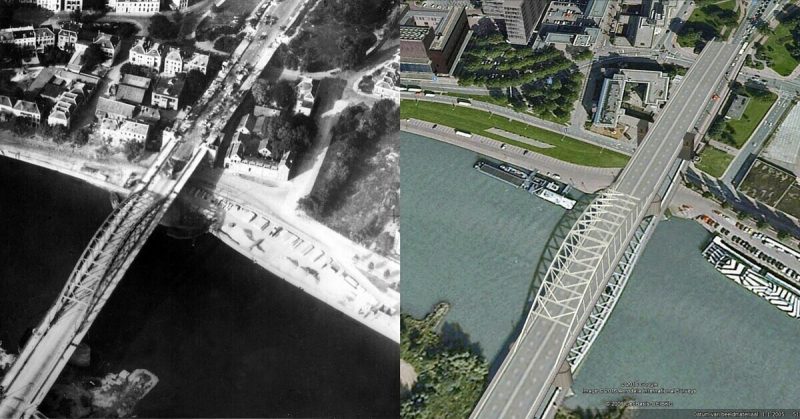
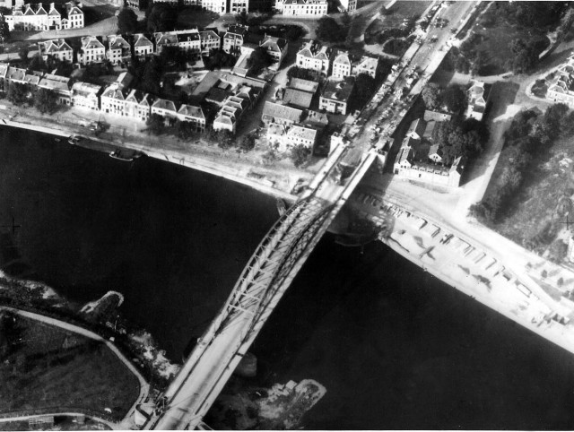
Aerial reconnaissance photo of the Arnhem road bridge taken by the Royal Air Force on 19 September, it shows signs of the British 1st Airborne division defending the northern ramp and the wrecked German vehicles from the previous day’s fighting.
Auschwitz 1944 / 2016
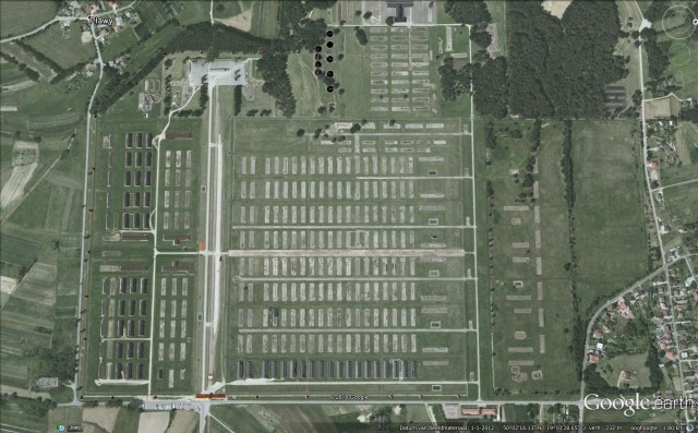
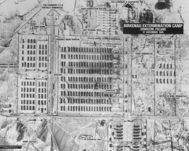
The “then” photo was taken by the 60 Photo-reconnaissance Squadron of the South African Air Force operating from southern Italy on May 31st, 1944 for bombing intelligence purposes. The photoreconnaissance plane was actually looking for the nearby IG Farben war production factory and other war production facilities in the area.
The captions and arrows you see on the pictures were added by two CIA researchers who reinterpreted the photo in 1978. The arrows point to a number of groups of inmates inside the camp. There are also several railcars visible next to the ramp and you can see smoke billowing from the chimney of crematorium V. This is a clear indication that shortly before, people were exterminated in the gas chamber beneath it.
