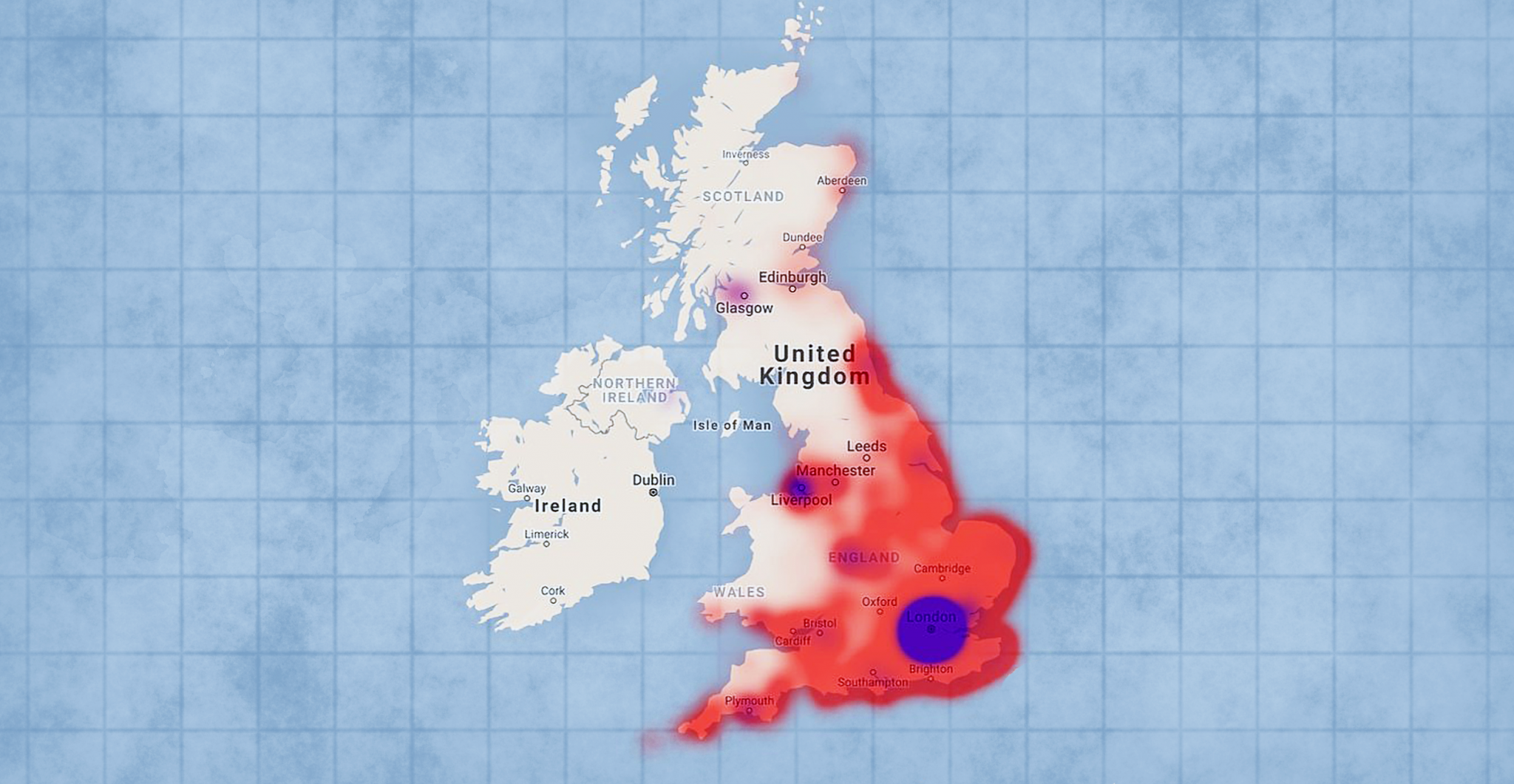
Experts at the University of York and the Britain’s National Archives have created an interactive map which shows the locations of over 30,000 air raids on Britain during WW2. It has detailed accounts of when and where bombs landed in the country between 1939 and 1944.
The records span from the first bomb to land near Edinburgh (on October 16, 1939, just six weeks after Nazi Germany invaded Poland) to the last one on the southeast coast of England (March 29, 1945).
A similar project mapped the bombs that fell on London during the war. This is the first time the entire country has been mapped out this way.
The map is free to use at http://www.warstateandsociety.com/Bombing-Britain. It is based on 6,500 reports from wartime intelligence officers for the Ministry of Home Security and senior officials.
Every single pin on the map shows another bomb that fell regardless of whether it exploded. Clicking on a pin reveals information about the air raid on that area including the date, location and number of casualties. The information is downloadable.

She confirmed that the first place to be bombed in Britain was the Firth of Forth in Scotland.
Bloomvall said that the map shows the astonishing scale of the war and how it was not confined to the battlefront. As the map illustrates, bombs fell during the air raids from the Orkney Islands to Coventry, from Liverpool to the Scilly Isles and from Dover to Swansea.
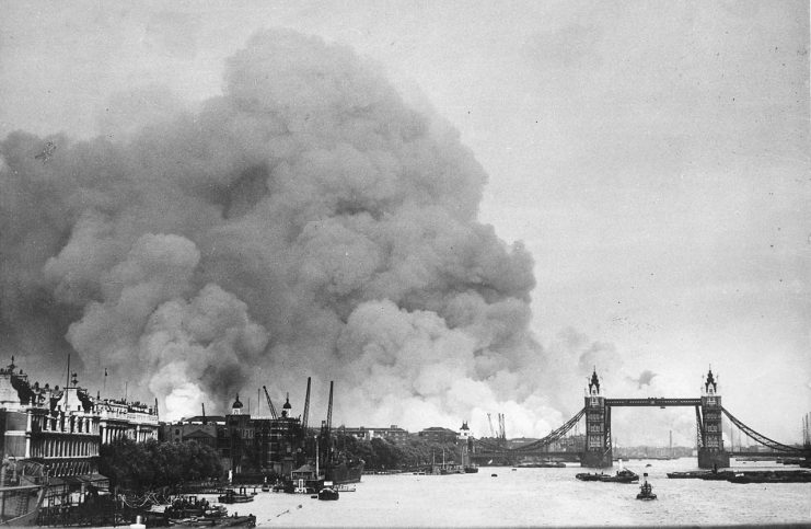
Approximately 30,000 tons of bombs were dropped in the UK during an intense German campaign known as “The Blitz.” The intent was to break the morale of British citizens and destroy British industry. It began on September 7, 1940, with 57 straight nights of bombings and ended just one month before D-Day, in May 1944. Over 40,000 people were killed during The Blitz.
To this day, unexploded bombs continue to be discovered in the country often requiring evacuations while the bombs are defused and removed.

Dr. George Hay is a military historian at The National Archives. He called the map “a fantastic resource,” not only for historians but for anyone with an interest in the impact of the air raids on the UK.
The map shows that London was the hardest hit location in the country. In part, this was due to the fact that it is located on the Thames River which German pilots followed to the city. Bombing was especially heavy during full moons when it was even easier for the pilots to locate their targets. Londoners began to refer to these times as “bombers’ moons.”
Over one million houses were destroyed or damaged in London alone. More than half of all bombing fatalities during the Blitz occurred in London.
Underground shelters were the safest place during the air raids but the government at first refused to allow citizens to take shelter in the tube stations to avoid interfering with travel. Eventually, they relented and it became a daily scene in London to see people lining up before the stations opened at 4pm.

Other cities with industrial complexes were heavily targeted as well. Coventry lost its medieval cathedral in the bombings as well as a third of its houses.
Another Article From Us: R/V Petrel Discovers Sunken Japanese Fleet Carrier Kaga
Bristol was the subject of a raid in which the Nazis dropped 1,540 tons of explosives and 12,500 incendiary devices in a single night. 207 people were killed in the attack.
