The research vessel Prince Madog with her crew of research scientists have solved a 77-year-old mystery about the disappearance of LCT 326, which disappeared in February 1943 while sailing from Troon in Scotland to Appledore in Devon.
LCT326 was a World War II landing craft. The LCT in LCT326 stood for Landing Craft Tank, and these were specially built landing craft designed to carry tanks and other armored vehicles.
They were made in large numbers toward the end of the war in preparation for the D-Day landings. Number 326 was built in Middlesbrough and launched in April 1942.

Admiralty records show that LCT326 was part of the 7th LCT Flotilla, under the care of HMS Cotillion, that left Troon in Scotland on the 31st January 1943, en route to Appledore in Devon. She was crewed by 14 men and was commanded by Temporary Sub Lieutenant William N Griffiths.
The records indicate that the weather was abysmal, and the flotilla was traveling very slowly and passed the Isle of Man during the day on the 1st February.
At 6:30pm that day, HMS Cotillion made a survey of the flotilla, and LCT326 was in position. The crew of HMS Cotillion noted that this check was done northwest of Bardsey Island.
LCT326 was never seen again.
The Admiralty believed that she had either hit a mine or sunk in a storm in the Irish Sea, off the coast of the Isle of Man.
Now 77 years later, the mystery of what happened to

has been solved by scientists from the School of Ocean Sciences, based at Bangor University in North Wales.
A team of technicians and marine scientists, working in conjunction with Dr. Innes McCartney, a well-known and respected historian and nautical archaeologist from Bournemouth University, had been plotting the sites of wrecks around the Welsh coast as part of a research project into the effect that wrecks have on the marine life.

The wreck was found south of Bardsley Island off the Llyn Peninsula in Northern Wales, more than 25 miles from where she was last seen. The debris is lying in an almost perfect line with the course the flotilla was following.
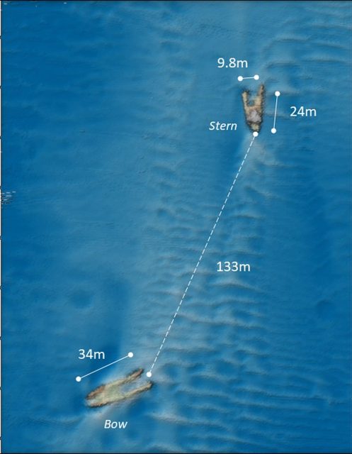
In 2019, the research team on board the Prince Madog used multibeam sonar to draw a picture of the wreck that they found in 90 meters of water.
https://www.youtube.com/watch?v=zyDE0wXHXKg&feature=emb_title
The dimensions gained from the sonar data showed the wreck was 10 meters wide and 58 meters long, with dimensions that fit the MKIII LCT craft.
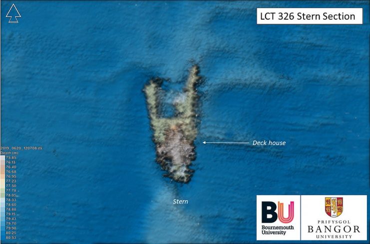
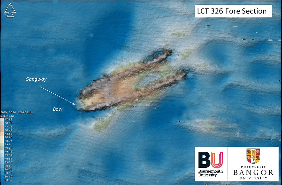
The data showed the distinctive features of this type of vessel, the landing gangway, and the deckhouse mounted on the stern.
The reason for the ship’s demise is unknown, and collision or mine cannot be ruled out. Still, the initial analysis indicates this may be a tragic accident.
Analysis of the data pointed out that this was an LCT type of craft, and research in Admiralty records revealed that this was tentatively identified as LCT326. This vessel had been missing for over 77 years.
It seems that the vessel had foundered in heavy seas and had broken in half just forward of the bridge. Both halves seem to have stayed afloat long enough to have drifted over 130 meters apart.
Dr. McCartney said, “The wreck of LCT 326 is one of over 300 sites in Welsh waters which have been surveyed by the Prince Madog, and the aim of this particular piece of research is to identify as many offshore wrecks in Welsh waters as possible and shed light on their respective maritime heritage. This aspect of the project has resulted in many new and exciting discoveries relating to both world wars, of which LCT 326 is just one example.”
The SEACAMS2 research project is being run by Bangor University on behalf of the offshore energy sector that builds installations such as offshore windfarms.
One of the project’s principal aims is to map the wrecks to better understand the interaction between marine life and the remains that lie on the seafloor.
Once the age of the debris is established, the data gathered about the growth of marine life and the state of the wreck is vital for the offshore renewable energy projects sector.
The lead researcher on the project, Dr. Michael Roberts, explained that identifying the wrecks was especially crucial to the project. Once they knew the wreck’s identity, they knew when it was sunk, and the age of the vessel when it sank.
They can collect data on the length of time the wreck has been on the bottom and the interaction between the debris and the marine life in the area.
Dr. Roberts said, “Wrecks such as LCT 326 and their associated physical and ecological “footprints” can often provide us with preliminary insights on the nature and properties of the surrounding seabed without having to undertake more complex, challenging and expensive geoscientific surveys.”
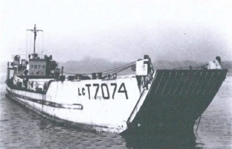
Iconic Last-of-its-Kind LCT 7074 About to Go On Display
As this is a naval grave, the location of the wreck has been forwarded to the Admiralty. This will allow the correct location of the vessel to be documented as well as the final resting place of the 14 crew members.
