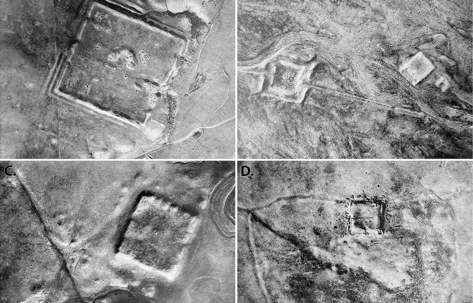
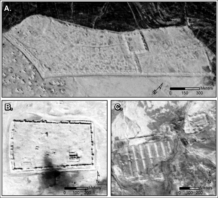
Declassified Cold War-era spy satellite images have revealed new details about the Roman Empire, as they show hundreds of previously undiscovered forts from the era. The photographs, captured during the 1960s and ’70s, show 396 sites in Iraq and Syria, according to a study published in the journal Antiquity.
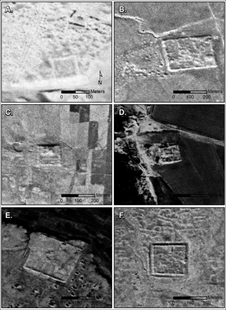
The study, titled “A wall or a road? A remote sensing-based investigation of fortifications on Rome’s eastern frontier,” does more than just prove the existence of the structures, it puts into question their purpose, with a widely-accepted theory from the 1930s now being put into question.
It was previously believed that the forts in this region were used as a form of defense against the Sasanian Empire, but it’s now being theorized that they were, instead, used to offer safe passage to travelers along a route that didn’t see much military traffic. The earlier theory was first posited by Jesuit missionary Father Antoine Poidebard.
“Since the 1930s, historians and archaeologists have debated the strategic or political purpose of this system of fortifications,” Jesse Casana of Dartmouth College in New Hampshire said in the study. “But few scholars have questioned Poidebard’s basic observation that there was a line of forts defining the eastern Roman frontier.”
The satellite images of the Roman-era forts were taken during two different US military programs: the Corona Project, which ran from 1960-72 and photographed the Soviet Union and China, and HEXAGON, a series of satellites that surveilled the USSR from 1971-86. The images collected during Corona were declassified in 1995, while HEXAGON’s were released to the public in 2011.
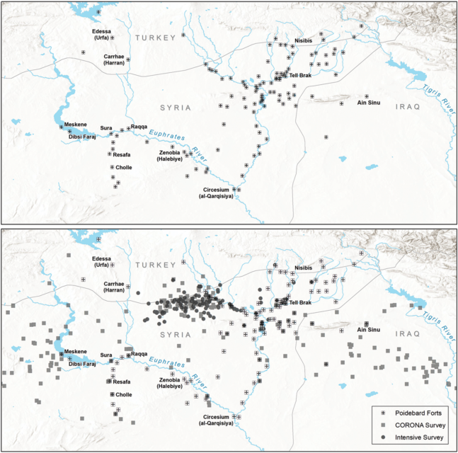
To locate the forts in the photos, the team sectioned off the images into five-kilometer squares and used reference maps from Poidebard’s aerial survey in the 1920s-30s. The French missionary had first noticed the structures while flying over the Syrian desert in a biplane and later uncovered 116 Roman-era forts.
Unfortunately, Poidebard’s maps were far from accurate and were missing key information, meaning the team had to pinpoint the already-discovered forts using nearby geological features.
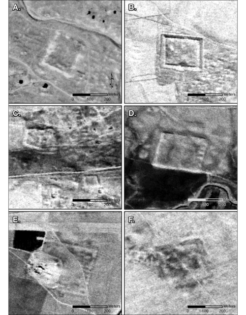
As they continued to study the satellite images, they found that the Roman forts didn’t just run in a singular line from north to south, as previously thought. Hundreds were also positioned from east to west, with 396 discovered across the Syrian Steppe, spanning 116,000 square miles.
“When you find something Roman, you know it. It’s big, and square, and stone,” Casana told Science.org. “One of the things that became apparent was there were a lot more square things out there than we realized.”
He added in an interview with Space.com, “These forts are similar in form to many Roman forts from elsewhere in Europe and North Africa. There are many more forts in our study than elsewhere, but this may be because they are better preserved and easier to recognize. However, it could have been a real product of intensive fort construction, especially during the second and third centuries AD.”
In regard to when they were built, the team believes they date back to between the second and sixth centuries.
More from us: The Tank Museum Releases Christmas Knit Collection
While the next steps would involve the team making plans to conduct an excavation, unrest in the region makes this far too dangerous an endeavor. The hope it to better examine the site once tensions have lessened.
