World War II was fought not just for resources, territory, and dominance, but also through the use of secret information. Both sides engaged in intelligence and counterintelligence activities, and while it’s tempting to believe these efforts focused on cutting-edge technology, that wasn’t always the case. In fact, during the early stages of the war, both the Allies and the Germans focused on something much simpler, yet equally important: the weather.
Weather played an important role in World War II
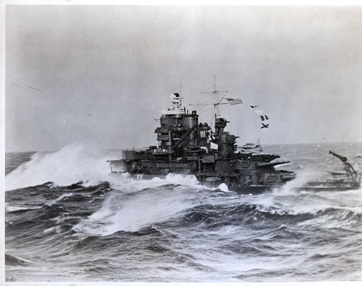
The Allies had an edge in what became known as the “North Atlantic Weather War.” In temperate regions, like the Arctic and areas north of the Atlantic, weather systems moved from west to east, benefiting the Allies. Early in the war, they had set up a network of weather stations across North America, Greenland, and Iceland, allowing them to provide their fleets with far more precise forecasts than the Germans could achieve.
As with any intelligence conflict, the objective was to gather data while preventing the enemy from accessing it.
Germany was far behind the Allies
Since the Germans were behind the Allies in the race for meteorological data, they used specially-modified aircraft, ships and U-boats to retrieve weather information. However, these missions proved to be quite dangerous. The Allies would easily destroy or capture a lonely weather vessel, and the aircraft weren’t of much use either.
They needed a way to collect the same amount of data as the Allies, but to do that, the German military needed weather stations on the North American continent: enter the Wetter-Funkgerät Land (WFL).
Wetter-Funkgerät Land
Scientists at Siemens developed an automatic weather station capable of transmitting data every three hours via radio waves on 3940 kHz. Known as the Wetter-Funkgerät Land, twenty-six were manufactured; 14 were placed in Arctic and sub-Arctic regions, including Allied-occupied Greenland, and five were stationed around the Barents Sea. Two were designated for North America.
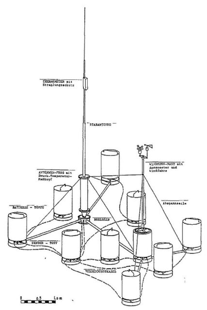
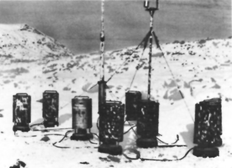
The WFL featured an array of specialized instruments, including two masts. One of these masts held the anemometer, which measured wind speed and direction. It also included a telemetry device that automatically recorded data and transmitted it via a radio signal. Powered by rechargeable nickel-cadmium batteries, it could operate for up to six months.
Two U-boats were assigned to install the automatic weather stations in North America. U-537 was the first and only one to successfully deploy the WFL, codenamed “Kurt.” The second, U-867, was sunk in 1944 near the Norwegian coast by a Royal Air Force (RAF) bomber.
Installing the Wetter-Funkgerät Land on North American soil
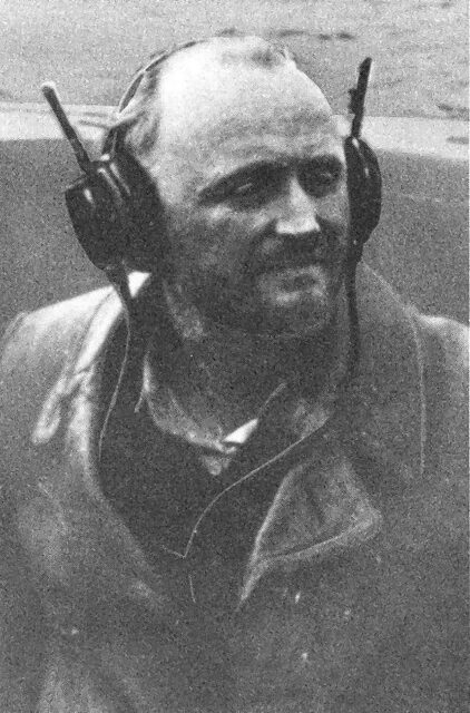
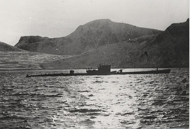
U-537, commanded by Kapitänleutnant Peter Schrewe, carried two meteorologists on board: Dr. Kurt Sommermeyer and Walter Hildebrant.
The journey itself proved perilous, not due to Allied patrols along the coast, but because of the severe weather. The U-boat became ensnared in a storm and collided with an iceberg. The damage was significant; U-537 lost its anti-aircraft cannon and developed a hull leak.
On October 22, 1943, U-537 reached the northern coast of Labrador. Schrewe determined that it was crucial to position the station as far from populated areas as possible. He recognized this would be difficult, given that the region was inhabited by the Inuit people, who frequently hunted in the remote north. It was essential for the Germans that the station remain concealed for as long as possible, so they anchored at the northeastern tip of the Labrador Peninsula, in Martin Bay.
Soon after, a scouting party surveyed the coast, while the meteorologists and sailors began assembling the 100-kg automatic weather station. Armed lookouts were placed around the perimeter to ensure that no one could surprise those setting up the Wetter-Funkgerät Land. Meanwhile, the rest of U-537’s crew worked to repair the damaged submarine.
Camouflaging Weather Station Kurt
Weather Station Kurt, as it became known, was marked with the logo and name of a non-existent company: Canadian Meteor Service. Empty American cigarette packs were also placed around the site, to make it more believable.
At that time, civilians were kept on a strictly need-to-know basis, so this camouflage made sense. It was even predicted by the Germans that lower-level military staff would also be confused and leave the station be, not wanting to ask questions.
Only 28 hours after arriving on the North American coast, U-537 was on her way home. Near Grand Banks, Newfoundland, her crew encountered a combat air and boat patrol and repelled three consecutive attacks by Canadian aircraft. She managed to escape the Canadians, but sank no ships. On December 8, 1943, after 70 days at sea, the U-boat was back in Lorient, in German-occupied France.
Becoming a forgotten part of World War II-era history
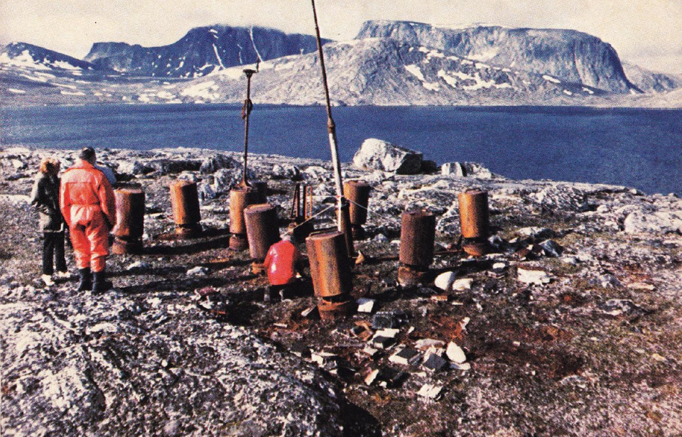
Weather Station Kurt only worked for a few weeks before failing, and it remained undiscovered long after World War II was over. In 1977, geomorphologist Peter Johnson was conducting research near Martin Bay when he stumbled upon the site. He thought it was a Canadian military outpost and simply marked it as “Martin Bay 7” on the map he kept during his research.
Around that same time, a retired Siemens engineer named Franz Selinger was writing a history of the company. He went through Kurt Sommermeyer’s papers and learned of the station’s existence. He subsequently notified the Canadian Ministry of Defence.
More from us: The Devastating Invasion That Kicked Off the Second World War
Want War History Online‘s content sent directly to your inbox? Sign up for our newsletter here!
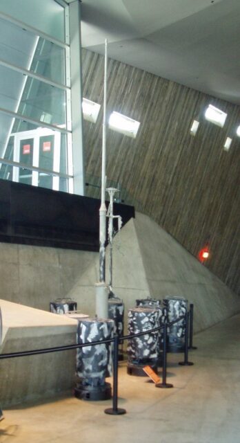
In 1981, Weather Station Kurt was officially discovered, standing on the same spot where the Germans had left it over 30 years prior. It was dismantled and taken to the Canadian War Museum in Ottawa, Ontario, where it remains on display to this day.
