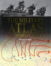
This large-scale book has the essence of the look of one produced under the banner of The Times newspaper, but don’t be fooled into thinking it relies on that coincidence to give it authority. The concept of showing the war in maps is one we have already covered. But whereas a previous title relied on contemporary maps for much of it’s presentation, author Michael Neiberg uses entirely new maps produced in a simple easy on the eye style. My late father-in-law, who loved atlases, always used to stress that the best maps were those that left off the clutter that can cause so much confusion. Mr Neiberg may well have been using a spiritualist to chat with dear old Jim because he is entirely on message here.
The book includes a range of events on a continental and local scale in real style and I always find this sort of stuff a pleasure. You will never sit down and do a cover-to-cover read through, unless you really are bored watching the Formula One practise sessions on the telly and need something to divert your attention away from car pointing. I like these books because I can enjoy a beverage and get through a bit at a time. So I can do naval battles, all the European land war stuff, the Easter Rising in Dublin, Zeppelin raids and so much more in easy instalments. It all works for me. The war on other continents, including events on the US-Mexican frontier; get colourful attention. Mr Neiberg has been thorough and given us a world war through the medium of a genuinely global atlas.
This is a very useful package. It has educational value for younger readers and I suppose it also fulfils all the general interest elements any sensible publishers look for to chase the Great War centennial shilling. I am happy to recommend it.
Reviewed by Mark Barnes for War History Online
THE MILITARY ATLAS OF WORLD WAR I
By Michael Neiberg
Published by Amber Books
ISBN: 978 1 78274 131 2
